Facilities
Approach Channel
2.5 nautical miles long, 200 metres wide. Maximum draft 10.6 metres.
Berths
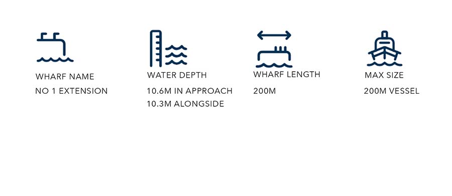
No. 1 Extension Wharf
Timber built wharf with a reinforced concrete deck, constructed on the inside of a concrete block breakwater. The wharf is equipped for handling oil, tallow, acids, palm oil and molasses. The wharf is also used for discharging bulk dry products.
No. 1 Wharf
Timber built wharf with a reinforced concrete deck. This is a general purpose wharf and is used by the fishing industry, general cargo, log exports, discharge bulk dry products, vessel layup and cruise ships.
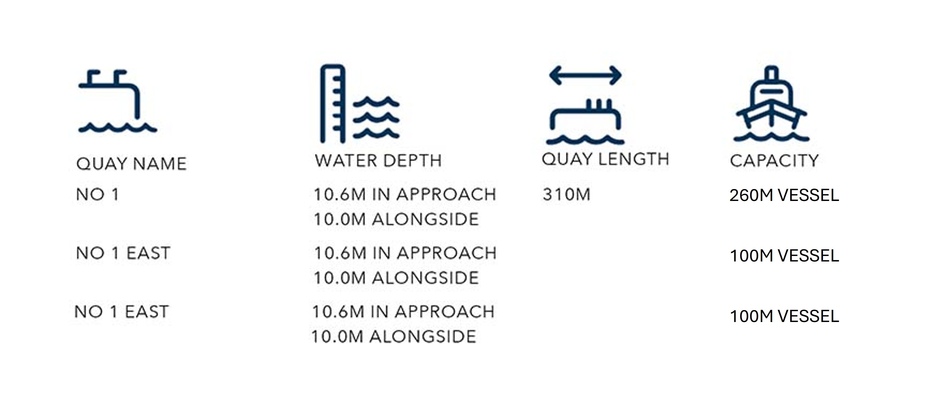
No. 2 Wharf
A heavy duty concrete and steel finger wharf constructed in 2015 for priority discharge of international cement bulk carriers and loading of coastal cement vessels (currently operated by Holcim New Zealand Limited). Also used for discharge of bulk dry products, including fertiliser and stock feeds.
The North Berth is used for unloading bulk carriers and the South Berth is used for loading coastal cement vessels. The South Berth is home to the regional coastal cement carrier. The North Berth doubles as a berth for unloading bulk dry product.

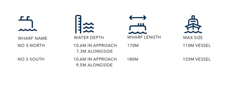
No. 3 Wharf
Timber built finger wharf with a reinforced concrete deck. This wharf is used extensively by the in shore fishing fleet and as a layup and maintenance berth for corporate fishing vessels. This is also the berth for PrimePort's two tugs.
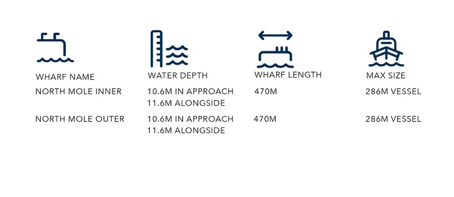
North Mole Wharf
The North Mole is a continuous 470m berth, with 75m constructed by heavy duty precast concrete. The wharf is predominately used for container operations, bulk dry unload Cruise vessels and heavy lift unloads.
Container operations are focused on North Mole Inner and bulk dry operations and Cruise vessels on North Mole Outer. The concrete section of North Mole Inner (75m) is used for heavy lift unload.
Harbourmaster’s Directions: Any class of vessel with LOA greater than 261m that has not previously visited the port shall be subject to an assessment by PrimePort Timaru pilots to confirm that its manoeuvring characteristics allow it to safely navigate within the pilotage area.
Port Access
Road
Northern road access via Port Loop Road (SH78) off State Highway 1.
Southern road access via Heaton Street off King Street.
Rail
Timaru Rail Depot and shunting yards are located adjacent to PrimePort and the Port Loop Road. Rail sidings extend into the North Mole Container Terminal and PrimePort Log Yard.